Open Pit Mine Plan Evaluation in Northern Alberta

HydroGeoSphere modelling to support mine operations and closure planning.


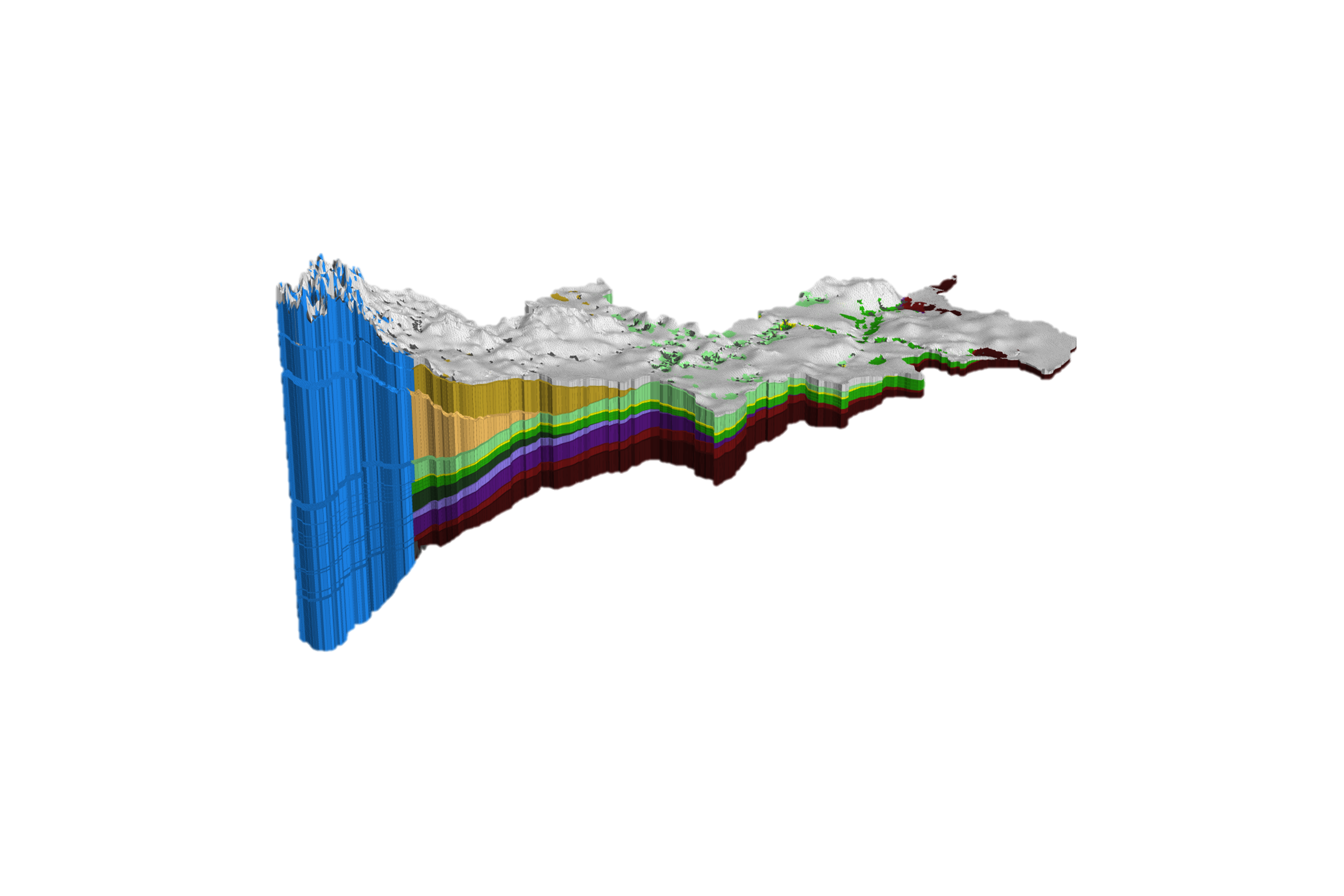
Developing an Initial State Hydrologic Model
A mine-scale HydroGeoSphere (HGS) integrated groundwater-surface water model can be used to assess the performance of different mine plan designs, both in terms of expected pit inflows during operation and the expected impact of mine operations to the surrounding landscape.

Exploring Climate Change Impacts on Mine Operations with HGS Modeling
Additionally, various climate change forecasts can be used to drive the HGS model to investigate the potential impact of climate change on mine operations.

Optimizing Mine Closure Design with HGS Simulation Technology
HGS simulation technology is emerging as an integral part of mine closure design optimization to verify that post-mining hydrologic conditions meet regulatory criteria.

Benefits
-
Boost operational efficiency
-
Foster interdisciplinary collaboration
-
E
-
Reduce uncertainty
-
Secure regulatory approval
-
Model the entire mine life-cycle
-
Improve accuracy
Applications
-
Engineering scenario support for mine mitigation strategies and closure planning; model water quantity and quality impacts from mine pit advance, backfilling, and reclamation activities.
-
HGS allows you to provide real-time forecasting of water budgets from pit dewatering, tailings ponds management, & regional groundwater and streamflow
-
Estimate dewatering needs of underground infrastructure and open-pit designs.
-
Hydraulic and tracer experiments for site characterization.
-
Reclamation design verification; a physics-based modelling approach to engineered designs.
-
Long-term predictions for mine scenarios, closure planning, and climate change impacts.
-
Improve accuracy


Key Features
• HGS fully-integrated groundwater surface water modeling boosts operational efficiency and fosters interdisciplinary collaboration by eliminating the need for separate surface/groundwater teams/models.
• Enhanced decision support using HGSRT (near real-time daily simulations) providing comprehensive understanding of mine-water management; including pit dewatering, tailings ponds, and regional groundwater/streamflows.
• Reduce uncertainty with HydroGeoSphere’s physics-based approach; ideal for modeling designed topographies & engineered systems.
• Successfully model hydrologic impacts of mine evolution including pit advance, backfilling, and reclamation activities. HGS has secured regulatory approvals for open-pit and underground operations in diverse geological settings.
• Model the entire mine life-cycle and topographic evolution in a single continuous simulation using Aquanty’s patented dynamic meshing technology.
• Improve understanding of hydrologic systems by simulating explicit water exchanges between domains. Use the unique Hydraulic Mixing Cell technique to trace the origin and fate of tagged water sources.
• Evaluate preferential flow paths using several methods including equivalent porous medium, dual domain formulation and discrete fracture networks.
• Enhance flow solution precision with polygon tracking, providing detailed reporting of lateral and vertical flows at any scale
Let our experts guide you through our cutting-edge technology and demonstrate how our services can address your specific needs.
Schedule Your Demo of HGS