Water Resource Analysis: Jeju Island, South Korea

A mountain lake surrounded by green grassy slopes and rocky terrain under a blue sky with clouds.

Exploring Water Dynamics on Jeju Island.

3D topographic map with red outer edge, green ridge, and blue terrain, showing elevation changes.
Topographical map of a lake with color gradient highlighting underwater features, surrounded by a 3D land boundary, with red shaded areas indicating specific regions.

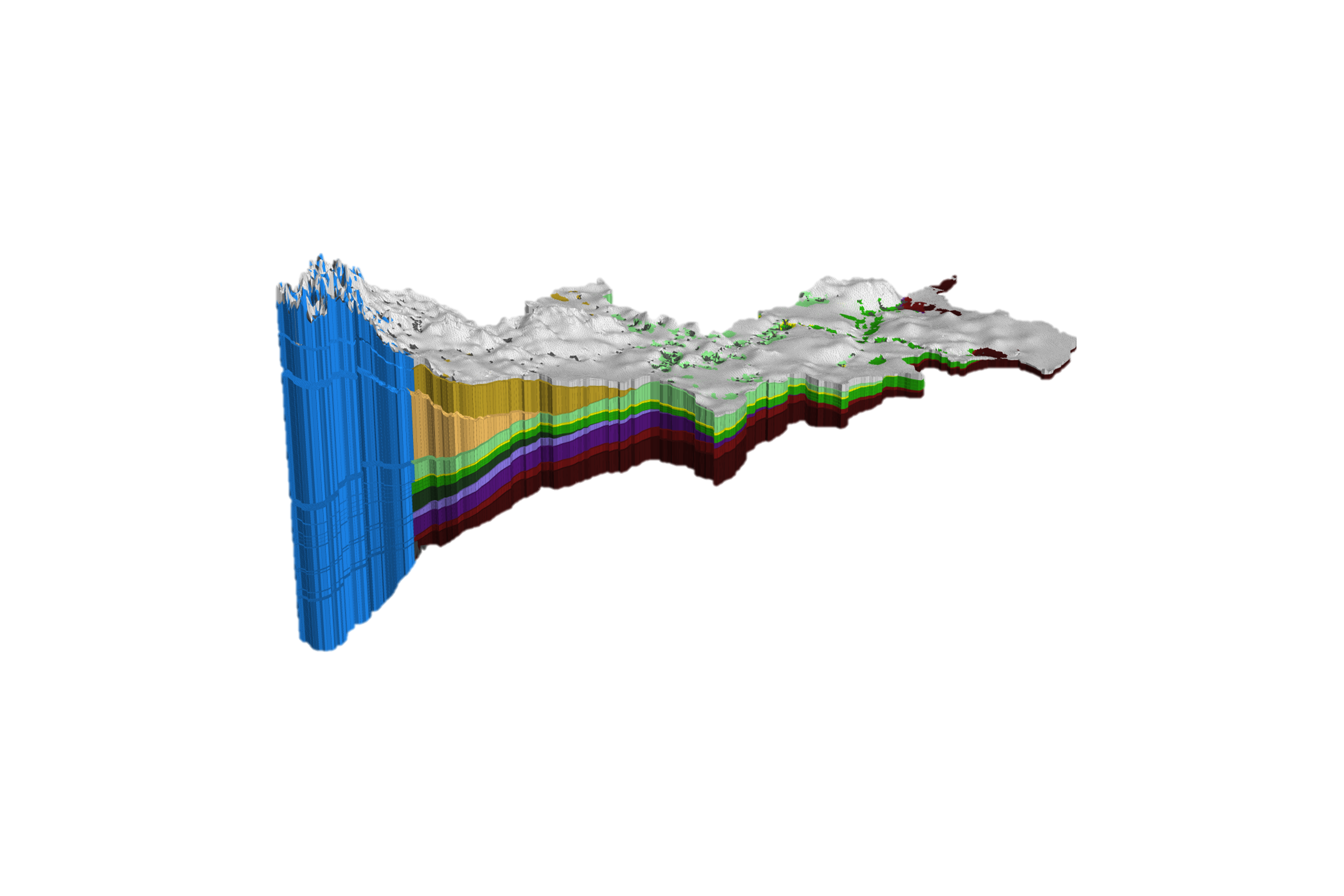
Hydrologic Data Management with Regional-Scale Integrated Models

A regional-scale integrated hydrologic model can serve to consistently integrate and manage hydrologic data sets.

Tracking Groundwater Systems

An example in a volcanic island of Jeju, South Korea indicates that there are various distinct groundwater systems with different characteristic such as a mountainous recharge system, an active coastal groundwater system, a stable deep freshwater system, and a saline groundwater system.

The regional model helped to better interpret and manage water resources in the island.

Color-coded diagrams of vertical and horizontal Darcy flux in a layered geological formation, showing flow directions with various color gradients representing flow rates from 0.0001 to 0.1 meters per day.
A 3D simulation graphic showing the transit time in years across a region outlined in black, with color-coded sections indicating transit times from 1 to 100,000 years, using a gradient from blue to red.
A 3D model of Indiana with a color-coded map indicating mean age in years, ranging from 1 to 1,000,000, using a gradient from blue to red.

Let our experts guide you through our cutting-edge technology and demonstrate how our services can address your specific needs.

Schedule Your Demo of HGS

Explore our other use cases