
Integrated Hydrologic Modelling for Nuclear Waste Management
Integrated groundwater– surface water hydrologic modelling is ideal for assessing the viability of nuclear waste repository sites and site design performance, in terms of both long-term operations and contaminant release scenario analysis.
The HydroGeoSphere (HGS) approach provides an accurate and robust method of simulating radionuclide transport in support of infrastructure decommissioning analysis. HGS also provides state-of-the-art means to investigate the potential impact of climate change on site hydrologic conditions, and on contaminant plume migration.
Benefits of Integrated Hydrologic Modelling
Confidently seek regulatory approval
Minimize uncertainty
Increase operational efficiency
Mitigate risk
Improved understanding of surface/subsurface hydrology

Minimize uncertainty inherent in empirical modelling techniques by relying on HydroGeoSphere’s physics-based approach to hydrologic modelling.

Optimize efficiency of tunnel dewatering operations by incorporating excavation damage and grouted tunnel zones.

Optimize site-location of deep geologic repositories using the backward-in-time transport simulation capabilities.

Increase operational efficiency by removing the need for distinct surface/groundwater teams/models and ensure fidelity across surface and subsurface domains.

Improved understanding of preferential flow paths via a dual domain formulation, or the incorporation of fracture networks as discrete model components.

Mitigate risk of environmental contamination through unlimited scenario analysis. Model the fate of radionuclide solutes across all model domains.

Full support and integration of MOFRAC generated discrete fracture networks.

Improve precision of flow solution in areas of interest using precise polygon tracking water movement through areas of any scale.
Special Projects
Aquanty’s HGS simulation technology is emerging as an integral part of mine closure design optimization to verify that post-mining hydrologic conditions meet regulatory criteria.

Steady-state density-driven flow and transport: Pseudo-transient parameter continuation:
Density-driven flow and transport is one of the dominant physical processes in coastal aquifer systems.


Large-scale numerical simulation of groundwater flow and solute transport in discretely-fractured crystalline bedrock:
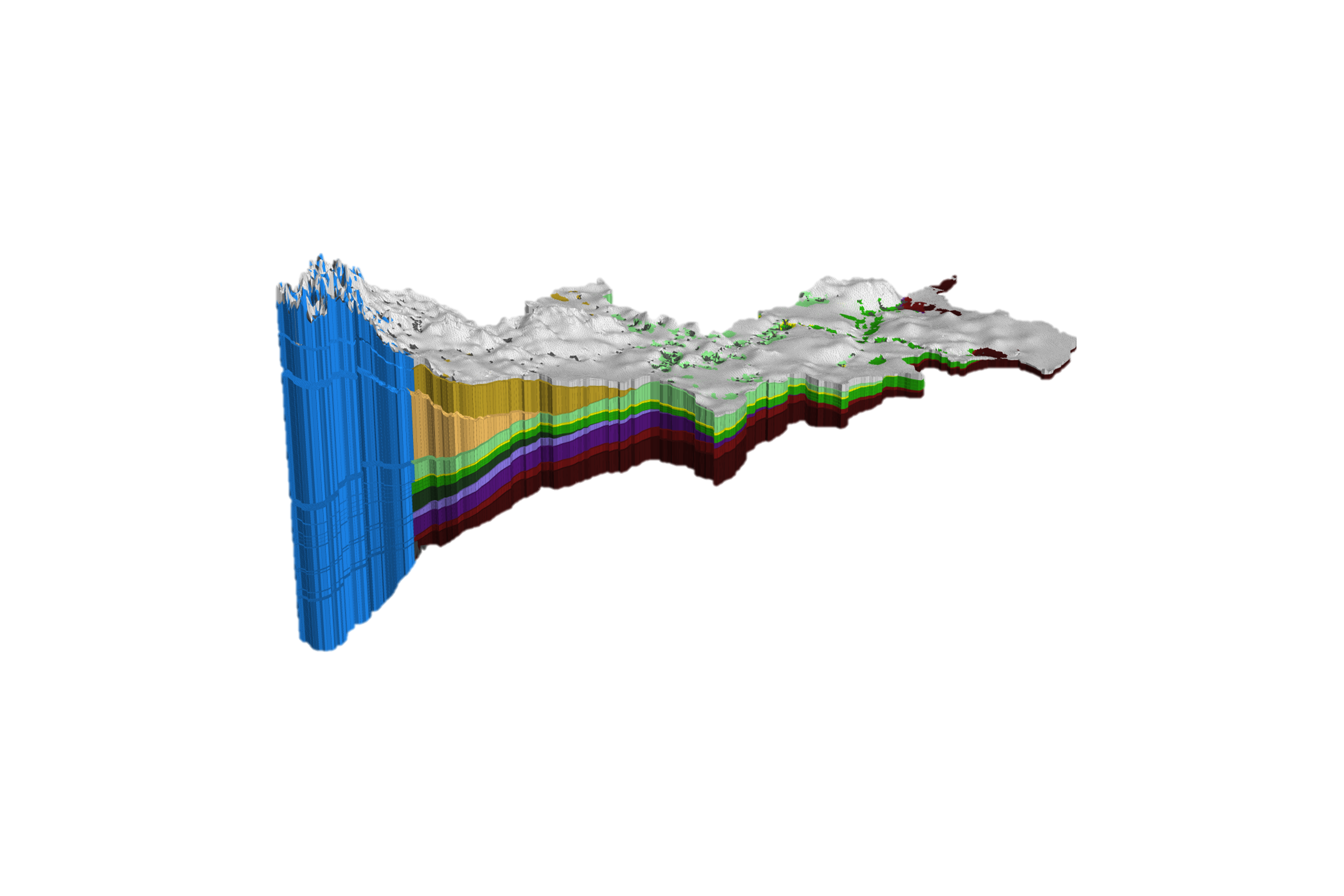
A large-scale fluid flow and solute transport model was developed for the crystalline bedrock at Olkiluoto Island, Finland, which is considered as potential deep geological repository for spent nuclear fuel. HydroGeoSphere is used here to simulate saturated subsurface flow and solute transport in the discretely-fractured porous bedrock of Olkiluoto.

Improving precision in regional scale numerical simulations of groundwater flow into underground openings:
Long-term predictions for mine scenarios, closure planning, and climate change impacts
-
![]()
Climate Change Impact Analysis
-
![]()
Water Resources Engineering and Consulting
-
![]()
Watershed Management and Decision Support
-
![]()
Mine Operations and Closure Planning
-
![]()
Agriculture & Forestry
-
![]()
Nuclear Waste Management
-
![]()
Flood and Drought Risk Management, Insurance
-
![]()
Coastal Hydrology, Thermal Energy Transport and Density-Dependent Flow Applications


Let our experts guide you through our cutting-edge technology and demonstrate how our services can address your specific needs.