
HGS RESEARCH HIGHLIGHT - Incorporating Surface Water Operations in an Integrated Hydrologic Model: Model Development and Application to the Lower Republican River Basin, United States
AUTHORS: A. Brookfield, C. Gnau, and B. Wilson
Few river systems remain unaltered by engineered water management structures. Yet research investigating the interdependence between natural and engineered components of a hydrologic system within a modeling framework is limited. Most current models either focus on the natural system, incorporating only a portion of the engineered structures and often excluding elements like reservoir operations, or focus on the engineered system, simplifying the temporal and spatial variations of the surface water/groundwater flow system. The objective of this work is to link an object-oriented model of surface water operations to a physically based, fully integrated surface/ subsurface hydrologic model to capture the effects of water management decisions on the groundwater and surface water flow systems. The capabilities of the new linked modeling framework are demonstrated in the heavily managed Lower Republican River Basin (LRRB) in portions of Nebraska and Kansas in the central United States. This area of the basin contains two storage reservoirs and a network of surface water canals from seven irrigation districts, in addition to thousands of diversions from groundwater and surface water irrigators. The linked model was able to reasonably represent the surface and groundwater flow conditions and demonstrated the interdependence between the surface water operations and the groundwater/surface water flow system. The temporal variability of groundwater/surface water interactions has a significant impact on reservoir operations and streamflow. This work demonstrated how integrating surface water operations and groundwater/surface water flow components into a model improves the representativeness of the simulated results and better captures the temporal and spatial variations in hydrologic processes occurring within the domain.
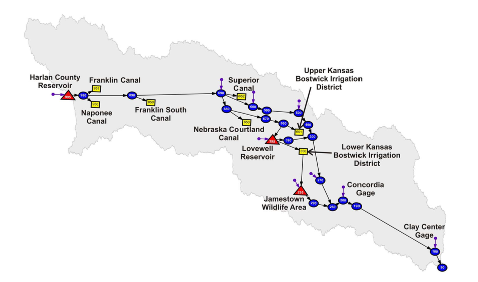
OASIS lower Republican River model schematic