
HGS RESEARCH HIGHLIGHT – Evaluating Domestic Well Vulnerability to Contamination From Unconventional Oil and Gas Development Sites

Soriano, M. A., Jr., Siegel, H. G., Gutchess, K. M., Clark, C. J., Li, Y., Xiong, B., Plata, D. L., Deziel, N. C., & Saiers, J. E. (2020). Evaluating Domestic Well Vulnerability to Contamination From Unconventional Oil and Gas Development Sites. In Water Resources Research (Vol. 56, Issue 10). American Geophysical Union (AGU). https://doi.org/10.1029/2020wr028005
Soriano, M. A., et al (2020)
This study by researchers at Yale University and the Institute of Technology investigates how vulnerable groundwater wells are to contamination by the growing unconventional oil and gas development industry, which is expanding quickly and, in some cases, negatively impacting groundwater quality and posing a risk to public health by contaminating drinking water sources. This study focused on Bradford County in northeastern Pennsylvania, where about 56% of the population rely on personal wells for drinking water. There are several benefits to unconventional oil and gas development, boosting local economies and producing relatively clean-burning burning natural gas. However, the industry relies heavily on horizontal drilling and hydraulic fracturing, which can put public and environmental health at risk i.e., hydraulic fracturing impacts the groundwater system.
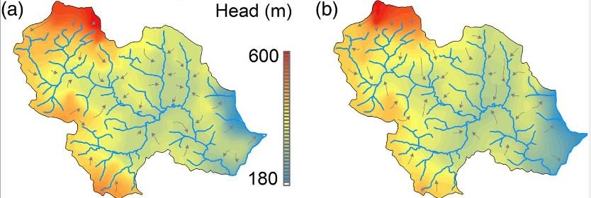
There are already many studies on this topic, but this paper uses numerical HydroGeoSphere flow and transport modelling to estimate solute transport distance and uses capture probability to evaluate well vulnerability. Spills and leaks in this industry are inevitable, and being aware of the potential spread of contamination is a necessary first step to understanding the vulnerability of drinking water supplies. This study has four main stages to evaluate the probability of drinking water contamination. First, a groundwater flow model is constructed using HydroGeoSphere. The flow model is then calibrated using historical observations. Next, the capture probability transport is simulated and finally a vulnerability assessment is performed for each well. This contamination diffusion model aims to simulate the worst-case scenario and the model was vertically discretized with 21 sublayers ranging from 0.5m to 50m thickness. A capture probability approach was used to quantify the vulnerability of domestic drinking water wells. Finally, a source-pathway-receptor framework was implemented.
This method proved to be an accurate risk assessment tool and can be used in addition to other evaluation techniques. Most wells had a low vulnerability as the capture zones were far enough away from any unconventional oil and gas development.
CLICK HERE TO READ THE ARTICLE.
Abstract:
The rapid expansion of unconventional oil and gas development (UD), made possible by horizontal drilling and hydraulic fracturing, has triggered concerns over groundwater contamination and public health risks. To improve our understanding of the risks posed by UD, we develop a physically based, spatially explicit framework for evaluating groundwater well vulnerability to aqueous phase contaminants released from surface spills and leaks at UD well pad locations. The proposed framework utilizes the concept of capture probability and incorporates decision‐relevant planning horizons and acceptable risks to support goal‐oriented modeling for groundwater protection. We illustrate the approach in northeastern Pennsylvania, where a high intensity of UD activity overlaps with local dependence on domestic groundwater wells. Using two alternative models of the bedrock aquifer and a precautionary paradigm to integrate their results, we found that most domestic wells in the domain had low vulnerability as the extent of their modeled probabilistic capture zones were smaller than distances to the nearest existing UD well pad. We also found that simulated capture probability and vulnerability were most sensitive to the model parameters of matrix hydraulic conductivity, porosity, pumping rate, and the ratio of fracture to matrix conductivity. Our analysis demonstrated the potential inadequacy of current state‐mandated setback distances that allow UD within the boundaries of delineated capture zones. The proposed framework, while limited to aqueous phase contamination, emphasizes the need to incorporate information on flow paths and transport timescales into policies aiming to protect groundwater from contamination by UD.