
HGS RESEARCH HIGHLIGHT – Impact of River Morphology on River–Groundwater Exchange in Braided River Systems
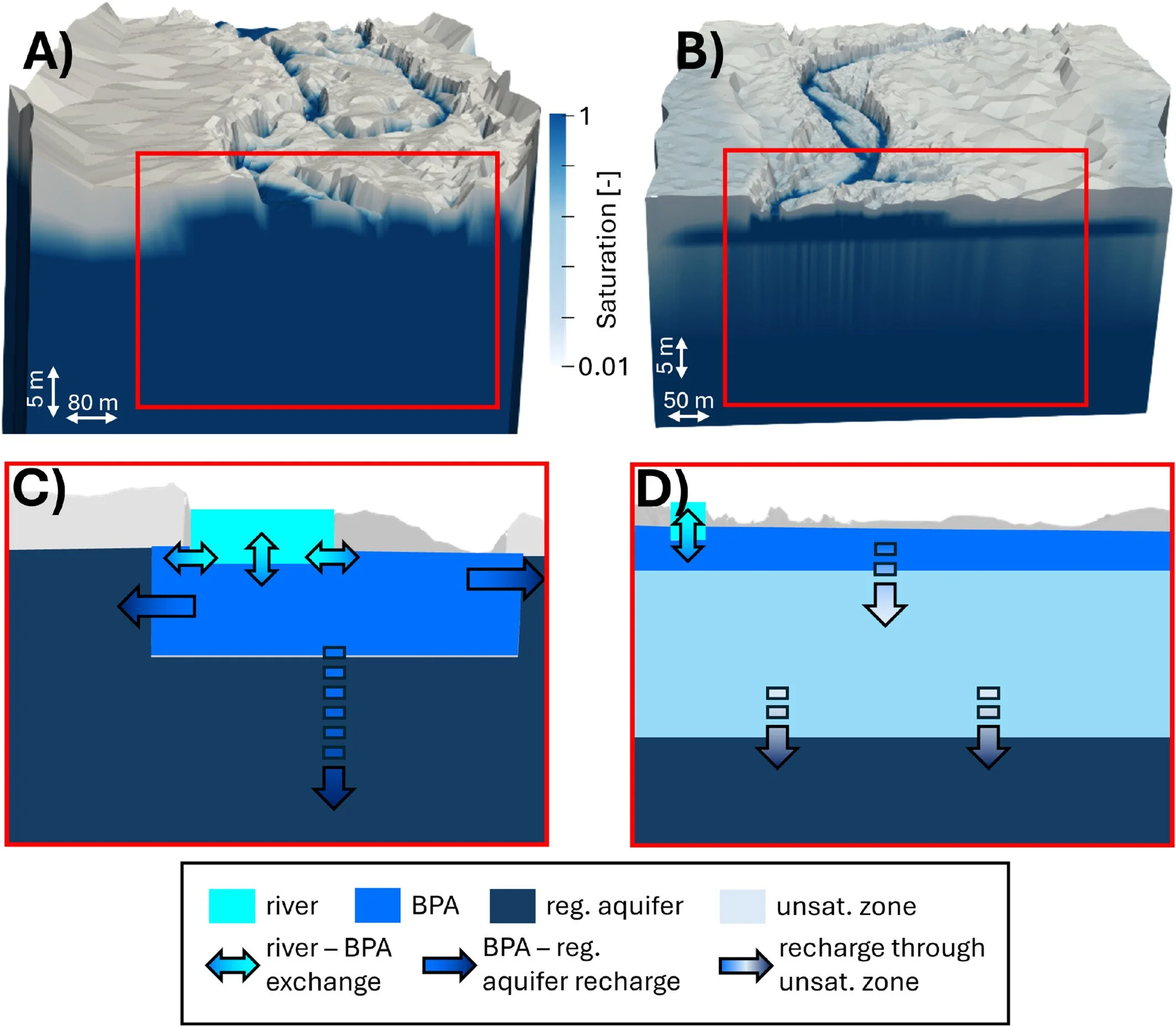
We're pleased to highlight this publication by Thomas Wöhling, Moritz Kraft and Antoine Di Ciacca, which investigates how flood-driven changes in braided river morphology influence river–groundwater exchange and aquifer recharge. Using HydroGeoSphere (HGS), the researchers developed fully coupled surface water–groundwater models of two braided river systems in New Zealand to isolate the effects of changing riverbed morphology before and after major flood events. The study demonstrates that morphological changes alone can significantly alter both recharge to shallow braidplain aquifers and subsequent recharge to regional groundwater systems.
Using a Hydraulic Mixing‑Cell to Characterize Surface Water – Groundwater Interactions in Snow‑Dominated Catchments - Aquanty Webinar
We’re pleased to share the recording of our recent webinar, Using a Hydraulic Mixing-Cell to Characterize Surface Water–Groundwater Interactions in Snow-Dominated Catchments. This session, presented by Benjamin Frot, PhD Candidate at Laval University, explores how integrated hydrologic modelling and innovative post-processing techniques can improve our understanding of groundwater contributions to streamflow, water age, and climate change impacts in snow-dominated watersheds.

Staff Research Highlight - Water Balance and Flow Tracer Application Using a Fully Integrated Hydrologic Model in a Pilot-scale Oil Sands Pit Lake Catchment
We're pleased to highlight this new publication by Aquanty staff, including Arghavan Tafvizi, James Ehrman, Ali Sharifinejad, Diana Zhang, Michael Callaghan, Steven Berg and Killian Miller, along with our collaborators at Suncor Energy Mike Wang, and Xiaoying Fan. This paper demonstrates the use of HydroGeoSphere (HGS) and the Hydraulic Mixing Cell (HMC) method to better understand water movement within a constructed end pit lake watershed. Using the Lake Miwasin Watershed in northern Alberta as a pilot-scale study site, the researchers developed and calibrated an integrated hydrologic model to simulate surface water, groundwater, lake levels, and evapotranspiration, while using HMC to identify how different areas of the watershed contribute to lake inflow under changing seasonal and climatic conditions.
HGS RESEARCH HIGHLIGHT – A hydraulic mixing-cell method to quantify the groundwater component of streamflow within spatially distributed fully integrated surface water–groundwater flow models
This research highlight co-authored by D. Partington, P. Brunner, C.T. Simmons, René Therrien, A.D. Werner, G.C. Dandy, and H.R. Maier, introduces a hydraulic mixing-cell (HMC) method to accurately quantify the groundwater component of streamflow within fully integrated surface–subsurface hydrologic models. This study leverages HydroGeoSphere (HGS) to address long-standing challenges in decomposing streamflow generation mechanisms without relying on tracer transport simulations or simplifying assumptions about groundwater discharge.

HGS RESEARCH HIGHLIGHT - Natural and anthropogenic drivers of the water table dynamics in a riparian fen peatland
This publication, co-authored by Adrien Renaud, Claude Mügler, Véronique Durand, and Marc Pessel, which examines the natural and anthropogenic drivers of water table dynamics in a riparian fen peatland along the Essonne River in France. This study leverages HydroGeoSphere (HGS) to couple surface and subsurface hydrology, providing new insights into how precipitation seasonality, vegetation activity, and river regulation influence peatland water levels.
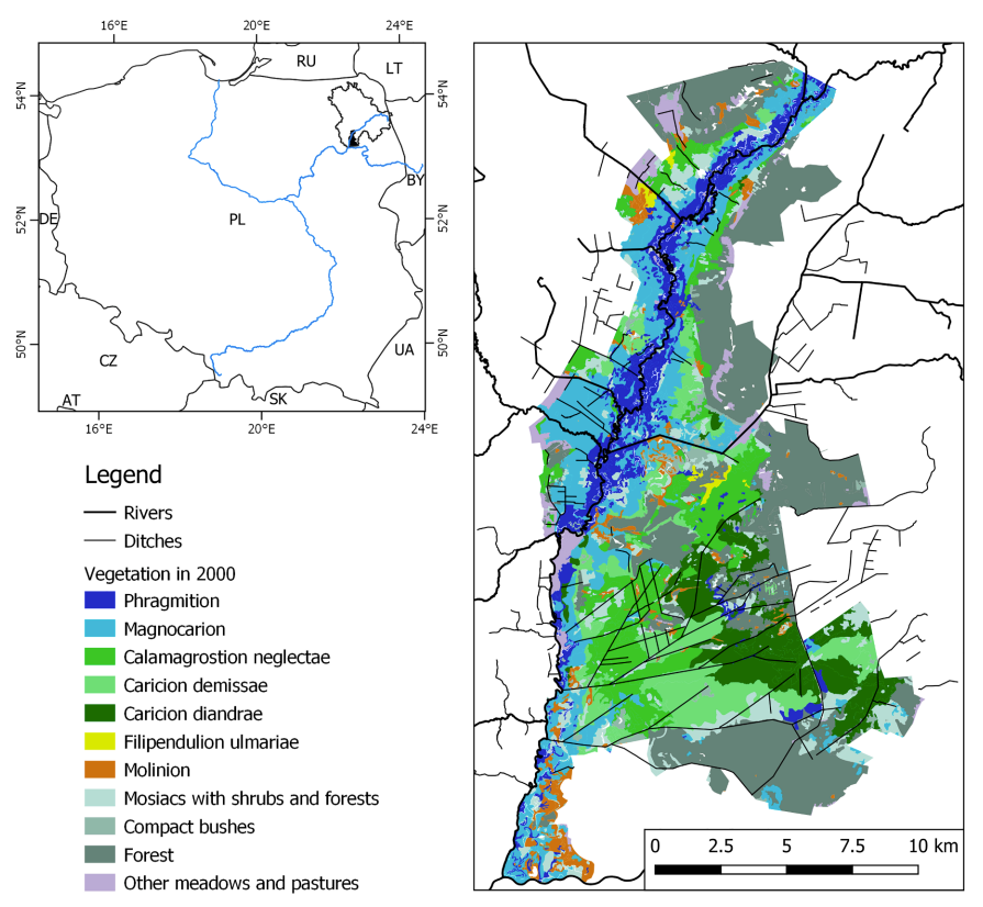
HGS RESEARCH HIGHLIGHT - Using water sources extent during inundation as a reliable predictor for vegetation zonation in a natural wetland floodplain
We’re pleased to highlight this publication, co-authored by Tomasz Berezowski and Martin Wassen, which investigates how the extent of water sources during inundation can be used as reliable predictors of vegetation zonation in wetland floodplains. This study leverages HydroGeoSphere (HGS) together with the Hydraulic Mixing-Cell (HMC) method to address long-standing challenges in modelling vegetation dynamics by explicitly accounting for the spatial distribution of different water sources during floods.

HGS RESEARCH HIGHLIGHT – External and internal drivers behind the formation, vegetation succession, and carbon balance of a subarctic fen margin
In this research publication, researchers investigated the formation, vegetation succession, and carbon balance of peatland margins in Finnish Lapland. This study leverages HydroGeoSphere (HGS) alongside paleoecological records and remote sensing to address long-standing challenges in understanding how new peatland areas initiate, expand, and influence climate through carbon cycling.
HGS RESEARCH HIGHLIGHT - Model simplification to simulate groundwater recharge from a perched gravel-bed river
This publication co-authored by Antoine Di Ciacca, Scott Wilson, Patrick Durney, Guglielmo Stecca, and Thomas Wöhling, investigates model simplification strategies to simulate groundwater recharge from perched gravel-bed rivers. This study leverages HydroGeoSphere (HGS) as a fully integrated 3D surface–subsurface model, alongside 2D cross-sectional and 1D analytical models, to address long-standing challenges in representing river–aquifer interactions while reducing computational demands.
Staff Research Highlight - Understanding topography-driven groundwater flow using fully-coupled surface-water and groundwater modeling
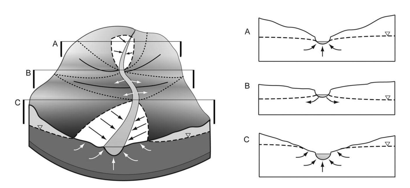
This research focuses on understanding the dynamics of topography-driven groundwater flow systems using fully-coupled surface–subsurface hydrologic modelling. This study addresses long-standing challenges in representing nested flow systems by simulating interactions between climate, topography, and groundwater without relying on potentially unrealistic, static boundary conditions.

HGS RESEARCH HIGHLIGHT – Vulnerability of the Saint-Charles drinking water source: portrait of the groundwater resources of the St-Charles River watershed and their links with surface water
We’re pleased to highlight this research effort, which focuses on understanding the vulnerability of the Saint-Charles River drinking water source and characterizing the groundwater resources that support it. Presented through a public-facing ArcGIS Story Map, this project delivers an accessible summary of a detailed hydrogeological study that integrates field measurements, geochemical analyses, and numerical modelling to evaluate the watershed’s current and future ability to provide safe, reliable drinking water for the City of Quebec and its surrounding municipalities.