
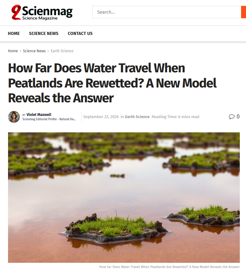
HydroGeoSphere Research Project Featured in Scienmag.
We’re pleased to share that recent research project media highlight using HydroGeoSphere (HGS) to investigate how rewetting propagates through restored peatlands has been featured in Scienmag in the article, “How Far Does Water Travel When Peatlands Are Rewetted? A New Model Reveals the Answer.” The feature highlights research by Omar Ashraf Nimr, Hannu Marttila, Okke Batelaan, Daniel Partington, and Pertti Ala-Aho, examining how different peatland restoration interventions influence water-table recovery across a boreal fen in northern Finland.
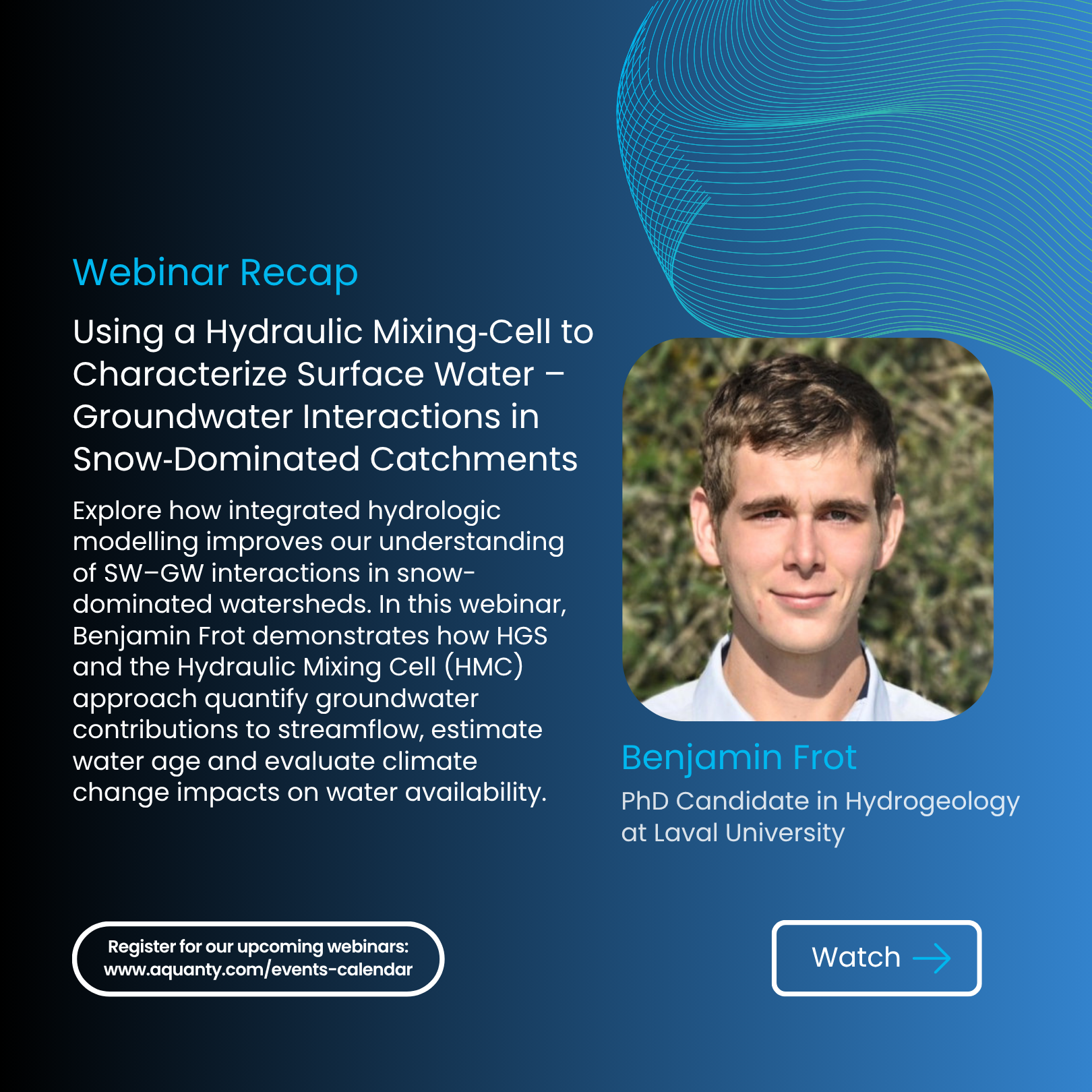
Using a Hydraulic Mixing‑Cell to Characterize Surface Water – Groundwater Interactions in Snow‑Dominated Catchments - Aquanty Webinar
We’re pleased to share the recording of our recent webinar, Using a Hydraulic Mixing-Cell to Characterize Surface Water–Groundwater Interactions in Snow-Dominated Catchments. This session, presented by Benjamin Frot, PhD Candidate at Laval University, explores how integrated hydrologic modelling and innovative post-processing techniques can improve our understanding of groundwater contributions to streamflow, water age, and climate change impacts in snow-dominated watersheds.
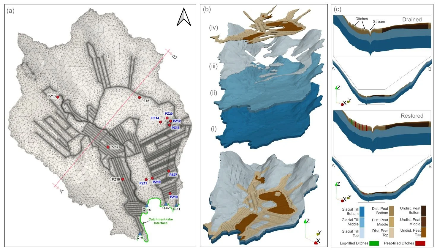
HGS RESEARCH HIGHLIGHT – How Does Rewetting Propagate Through Restored Peatlands? An Integrated Surface–subsurface Modelling Analysis of Water–table Dynamics
We’re pleased to highlight this publication, which investigates how peatland restoration alters groundwater table dynamics across drained boreal peatlands using fully integrated hydrologic modelling. This study leverages HydroGeoSphere (HGS) to simulate coupled surface–subsurface flow processes and evaluate spatial patterns of groundwater response following ditch blocking and rewetting interventions, addressing long-standing challenges in predicting restoration outcomes across heterogeneous peatland landscapes.
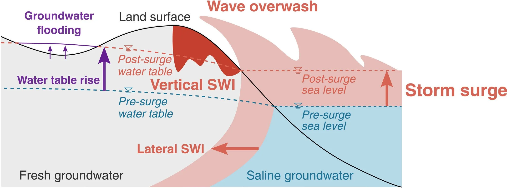
HGS RESEARCH HIGHLIGHT – Climate Change Alters Post-Surge Recovery of Coastal Aquifers
This publication co-authored by Satoshi Tajima, René Therrien and Philip Brunner investigates how climate change influences the recovery of coastal aquifers following storm surge events. This study leverages HydroGeoSphere (HGS) to simulate coupled groundwater flow and variable-density salt transport, addressing long-standing challenges in understanding how coastal aquifers respond to storm-driven seawater intrusion and how recovery dynamics may change under future climatic conditions.
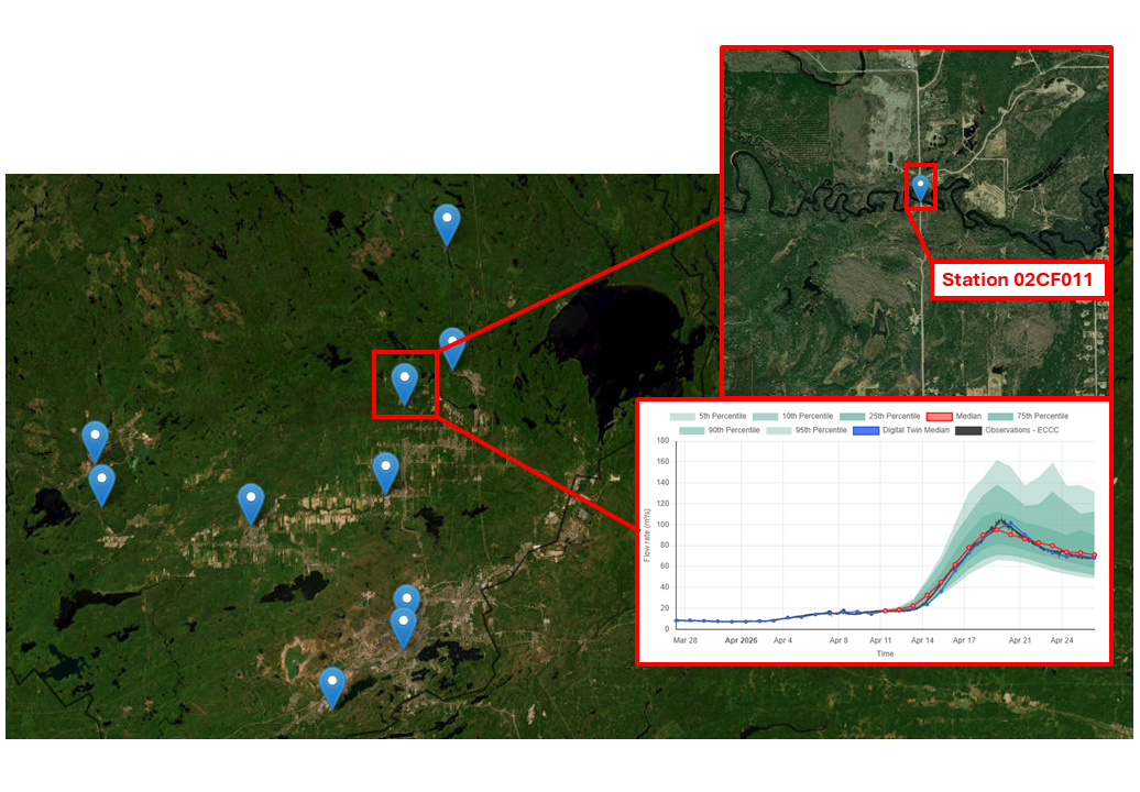
HydroSphereAI Case Study: Spring Freshet Forecasting for Hydropower Risk Awareness – Vermilion River Ontario (Station: 02CF011 - VERMILION RIVER NEAR VAL CARON) – April 2026
Between April 15 and April 22, 2026, watersheds across Greater Sudbury experienced a significant spring flood event driven by rapid snowmelt and sustained rainfall. A Flood Warning issued by Conservation Sudbury highlighted elevated inflows across the region, including the Vermilion River system near Val Caron.
While the Vermilion River is not a regulated hydropower system, Water Survey of Canada Station 02CF011 (Vermilion River near Val Caron) provides a comparable watershed area for understanding naturalized inflow dynamics relevant to hydroelectric operations across northern Ontario.
This case study demonstrates how HydroSphereAI (HSAI) captured the timing and magnitude of peak flows during a complex spring freshet event, and how similar forecasting capability can support hydropower decision-making.
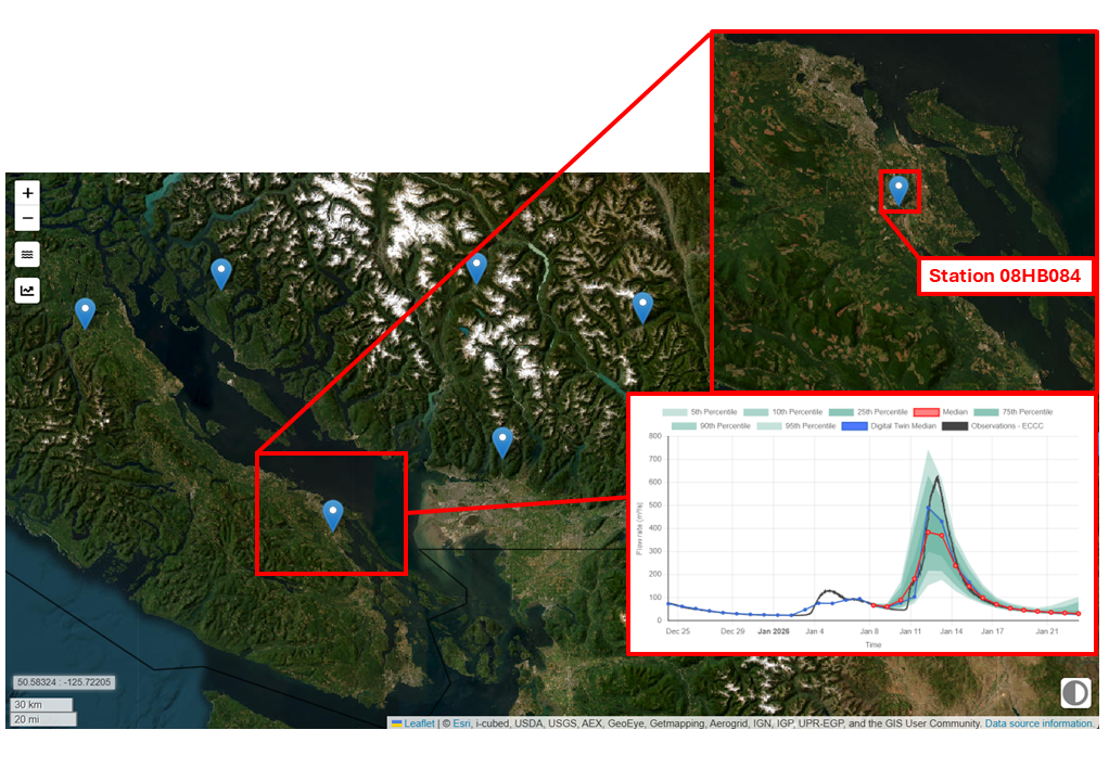
HydroSphereAI Case Study: Nanaimo River Near Cassidy – January 2026 High-Flow Event
On January 12, 2026, the Nanaimo River near Cassidy (Water Survey of Canada Station 08HB034) experienced a significant high-flow event, cresting at the 2-year flood mark. Winter storm systems sweeping across Vancouver Island brought prolonged precipitation to the watershed, driving river discharge well above average levels for the season. This case study highlights how an early release version of HydroSphereAI (HSAI) tracked the event and how this information could be used by stakeholders and water managers.
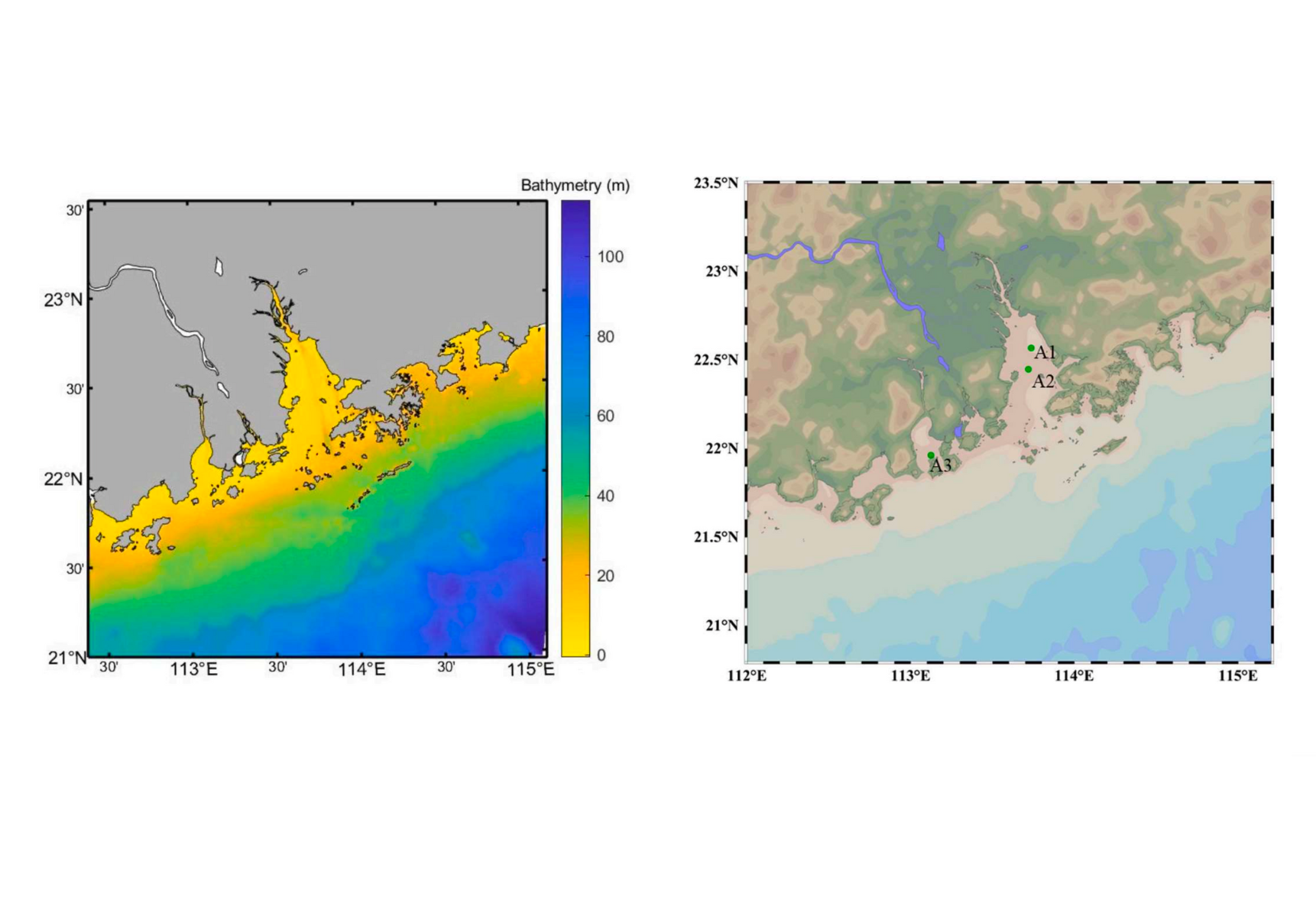
HGS RESEARCH HIGHLIGHT – Modeling the water use associated with energy consumption changes on saltwater intrusion in the Pearl River estuary, China
This research investigates how increased energy consumption and associated changes in water use impact saltwater intrusion in the Pearl River Estuary— one of China's most economically vital and environmentally vulnerable regions.
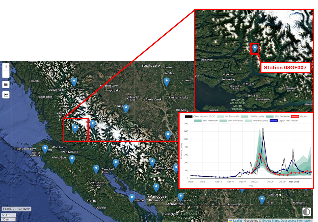
HydroSphereAI Case Study: Wakeman River
During October and November 2025, a series of back-to-back Pacific storm systems brought steady rainfall across the central coast of British Columbia. Such events are a common occurrence in the Pacific Northwest and are intensifying in a warmer climate.

HGS RESEARCH HIGHLIGHT - Natural and anthropogenic drivers of the water table dynamics in a riparian fen peatland
This publication, co-authored by Adrien Renaud, Claude Mügler, Véronique Durand, and Marc Pessel, which examines the natural and anthropogenic drivers of water table dynamics in a riparian fen peatland along the Essonne River in France. This study leverages HydroGeoSphere (HGS) to couple surface and subsurface hydrology, providing new insights into how precipitation seasonality, vegetation activity, and river regulation influence peatland water levels.
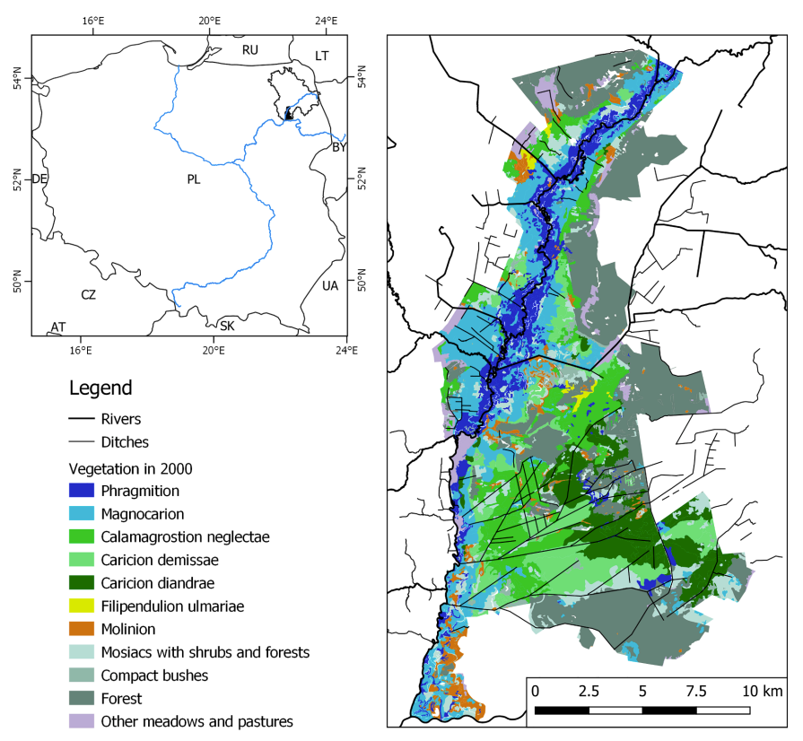
HGS RESEARCH HIGHLIGHT - Using water sources extent during inundation as a reliable predictor for vegetation zonation in a natural wetland floodplain
We’re pleased to highlight this publication, co-authored by Tomasz Berezowski and Martin Wassen, which investigates how the extent of water sources during inundation can be used as reliable predictors of vegetation zonation in wetland floodplains. This study leverages HydroGeoSphere (HGS) together with the Hydraulic Mixing-Cell (HMC) method to address long-standing challenges in modelling vegetation dynamics by explicitly accounting for the spatial distribution of different water sources during floods.