

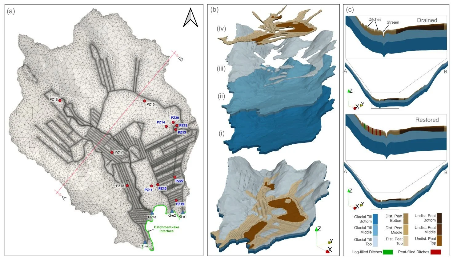
HGS RESEARCH HIGHLIGHT – How Does Rewetting Propagate Through Restored Peatlands? An Integrated Surface–subsurface Modelling Analysis of Water–table Dynamics
We’re pleased to highlight this publication, which investigates how peatland restoration alters groundwater table dynamics across drained boreal peatlands using fully integrated hydrologic modelling. This study leverages HydroGeoSphere (HGS) to simulate coupled surface–subsurface flow processes and evaluate spatial patterns of groundwater response following ditch blocking and rewetting interventions, addressing long-standing challenges in predicting restoration outcomes across heterogeneous peatland landscapes.
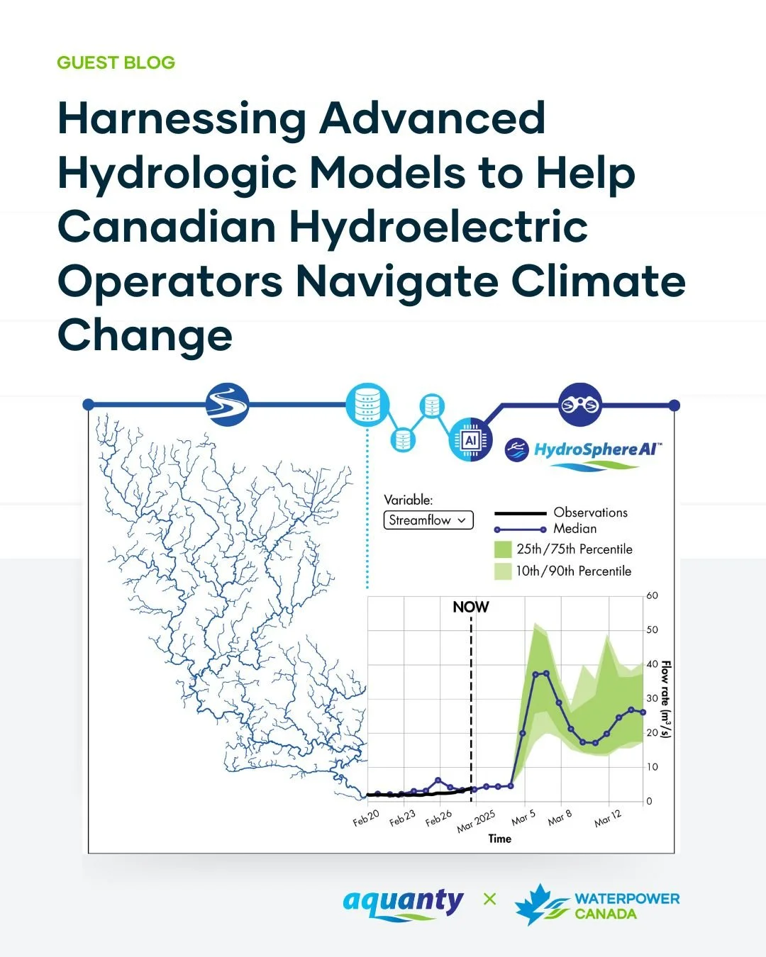
Aquanty Featured in WaterPower Canada Guest Blog: Navigating Climate Change in Hydropower
We’re pleased to share that Aquanty recently contributed a guest blog post to WaterPower Canada, authored by Dr. Andre Erler, Senior Climate Scientist at Aquanty. The article “Harnessing Advanced Hydrologic Models to Help Canadian Hydroelectric Operators Navigate Climate Change” explores how advanced hydrologic modelling and forecasting tools can help Canadian hydroelectric operators navigate increasing uncertainty driven by climate change.
HGS RESEARCH HIGHLIGHT – A hydraulic mixing-cell method to quantify the groundwater component of streamflow within spatially distributed fully integrated surface water–groundwater flow models
This research highlight co-authored by D. Partington, P. Brunner, C.T. Simmons, René Therrien, A.D. Werner, G.C. Dandy, and H.R. Maier, introduces a hydraulic mixing-cell (HMC) method to accurately quantify the groundwater component of streamflow within fully integrated surface–subsurface hydrologic models. This study leverages HydroGeoSphere (HGS) to address long-standing challenges in decomposing streamflow generation mechanisms without relying on tracer transport simulations or simplifying assumptions about groundwater discharge.
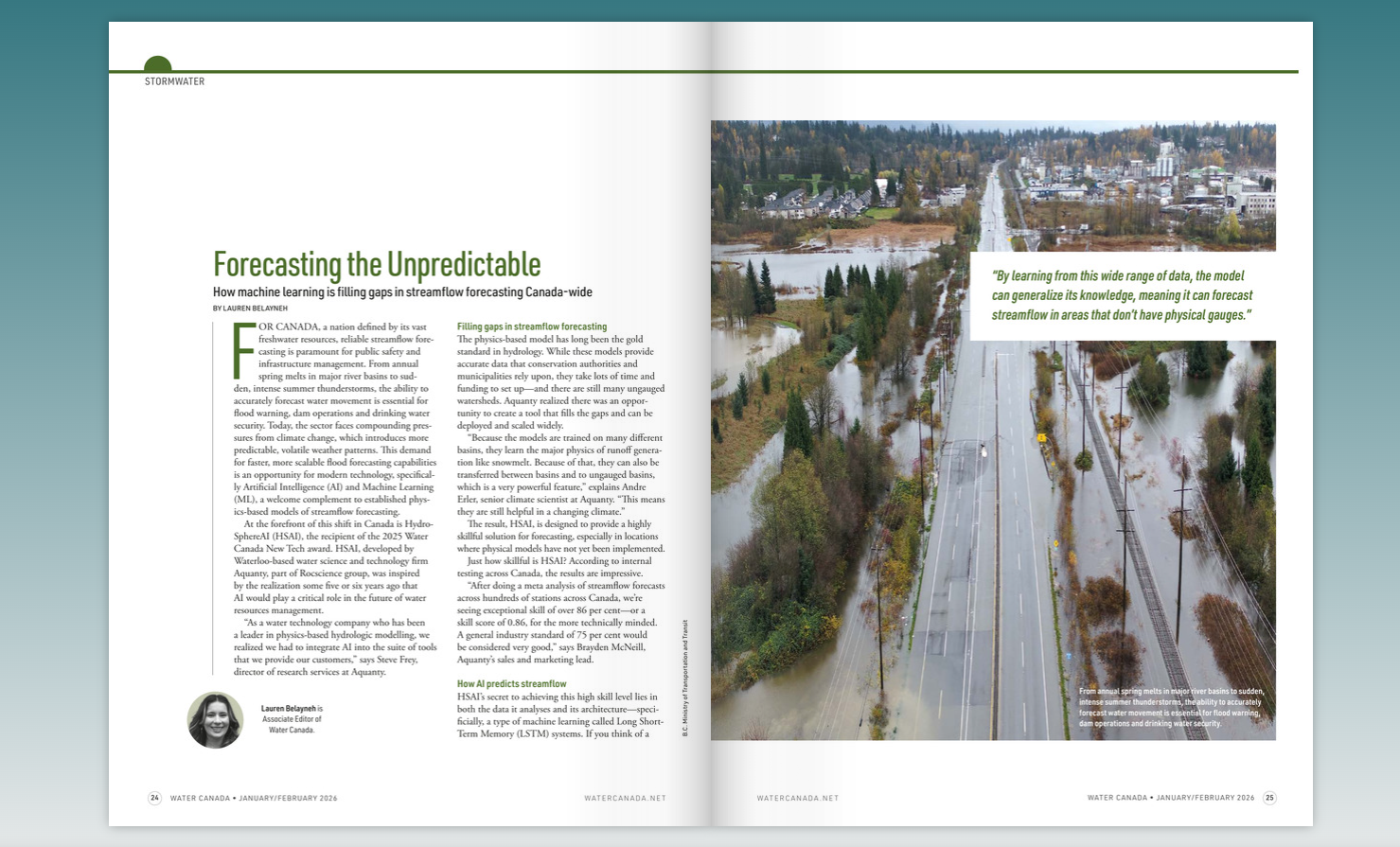
HydroSphereAI Featured in Water Canada’s January/February 2026 Magazine
We’re excited to share that HydroSphereAI (HSAI) is featured in the January/February 2026 issue of Water Canada, highlighting how machine learning is helping close critical gaps in streamflow forecasting across Canada.

HGS RESEARCH HIGHLIGHT - Natural and anthropogenic drivers of the water table dynamics in a riparian fen peatland
This publication, co-authored by Adrien Renaud, Claude Mügler, Véronique Durand, and Marc Pessel, which examines the natural and anthropogenic drivers of water table dynamics in a riparian fen peatland along the Essonne River in France. This study leverages HydroGeoSphere (HGS) to couple surface and subsurface hydrology, providing new insights into how precipitation seasonality, vegetation activity, and river regulation influence peatland water levels.
HGS RESEARCH HIGHLIGHT - Using water sources extent during inundation as a reliable predictor for vegetation zonation in a natural wetland floodplain
We’re pleased to highlight this publication, co-authored by Tomasz Berezowski and Martin Wassen, which investigates how the extent of water sources during inundation can be used as reliable predictors of vegetation zonation in wetland floodplains. This study leverages HydroGeoSphere (HGS) together with the Hydraulic Mixing-Cell (HMC) method to address long-standing challenges in modelling vegetation dynamics by explicitly accounting for the spatial distribution of different water sources during floods.

HGS RESEARCH HIGHLIGHT – External and internal drivers behind the formation, vegetation succession, and carbon balance of a subarctic fen margin
In this research publication, researchers investigated the formation, vegetation succession, and carbon balance of peatland margins in Finnish Lapland. This study leverages HydroGeoSphere (HGS) alongside paleoecological records and remote sensing to address long-standing challenges in understanding how new peatland areas initiate, expand, and influence climate through carbon cycling.
HGS RESEARCH HIGHLIGHT - Model simplification to simulate groundwater recharge from a perched gravel-bed river
This publication co-authored by Antoine Di Ciacca, Scott Wilson, Patrick Durney, Guglielmo Stecca, and Thomas Wöhling, investigates model simplification strategies to simulate groundwater recharge from perched gravel-bed rivers. This study leverages HydroGeoSphere (HGS) as a fully integrated 3D surface–subsurface model, alongside 2D cross-sectional and 1D analytical models, to address long-standing challenges in representing river–aquifer interactions while reducing computational demands.

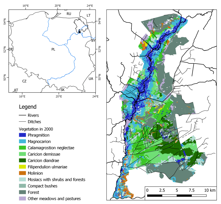
HGS RESEARCH HIGHLIGHT – Vulnerability of the Saint-Charles drinking water source: portrait of the groundwater resources of the St-Charles River watershed and their links with surface water
We’re pleased to highlight this research effort, which focuses on understanding the vulnerability of the Saint-Charles River drinking water source and characterizing the groundwater resources that support it. Presented through a public-facing ArcGIS Story Map, this project delivers an accessible summary of a detailed hydrogeological study that integrates field measurements, geochemical analyses, and numerical modelling to evaluate the watershed’s current and future ability to provide safe, reliable drinking water for the City of Quebec and its surrounding municipalities.
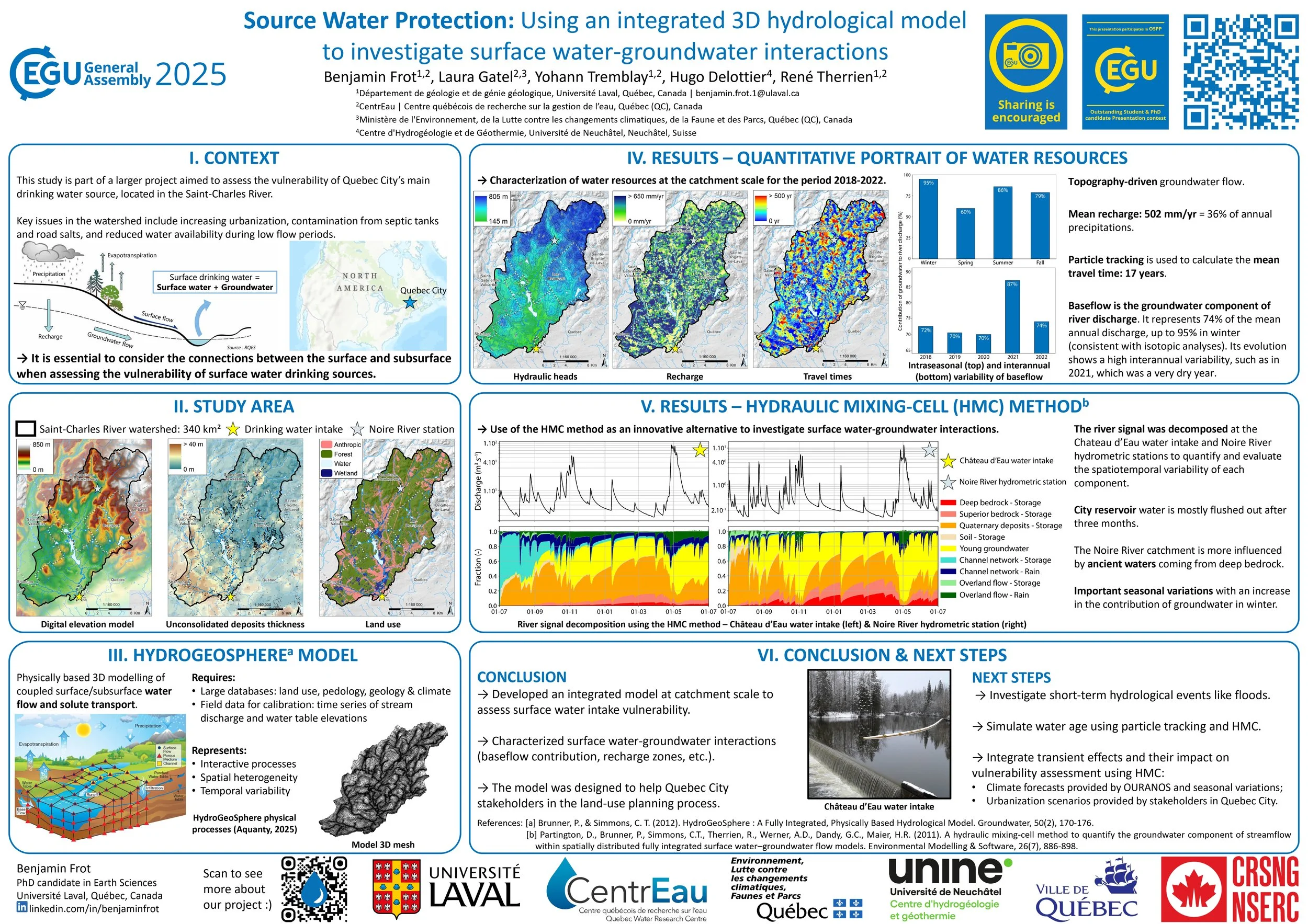
HGS RESEARCH HIGHLIGHT – Source Water Protection in Quebec City: Using an integrated 3D hydrological model to investigate surface water-groundwater interactions
The research, presented as a poster by Benjamin Frot at EGU 2025, explores the use of HydroGeoSphere (HGS) to investigate surface water–groundwater interactions in the Saint-Charles River watershed, which supplies drinking water to Quebec City. With a focus on source water protection, the study addresses the challenges posed by increasing urbanization, contamination from septic systems and road salts, and reduced water availability during low-flow periods. The work is part of a larger project aimed at evaluating the vulnerability of Quebec City's main surface water intake.