

Integrated Hydrologic Modelling for Nuclear Waste Management
Integrated groundwater–surface water hydrologic modelling is ideal for assessing the viability of nuclear waste repository sites and site design performance, in terms of both long-term operations and contaminant release scenario analysis.
HydroGeoSphere’s fully-integrated modelling approach provides a robust method of simulating radionuclide transport in support of infrastructure decommissioning analysis. HGS also provides state-of-the-art means to investigate the potential impact of climate change on site hydrologic conditions, and on contaminant plume migration through all transport pathways including discrete fracture networks.
Benefits
Confidently seek regulatory approval
Minimize uncertainty
Increase operational efficiency
Mitigate risk
Improved understanding of surface/subsurface hydrology
Minimize uncertainty inherent in empirical modelling techniques by relying on HydroGeoSphere’s physics-based approach to hydrologic modelling.
Increase operational efficiency by removing the need for distinct surface/groundwater teams/models and ensure fidelity across surface and subsurface simulation domains.
Mitigate risk of environmental contamination through unlimited scenario analysis. Model the fate of radionuclide solutes across all model domains including surface and discrete fracture networks.
Optimize efficiency of tunnel dewatering operations by incorporating excavation damage and grouted tunnel zones.
Optimize site-location of deep geologic repositories using the backward-in-time transport simulation capabilities, and understand the impact of climate change on long-term hydrology.

Improved understanding of preferential flow paths via a dual domain formulation, or the incorporation of fracture networks as discrete model components.
Featured Projects
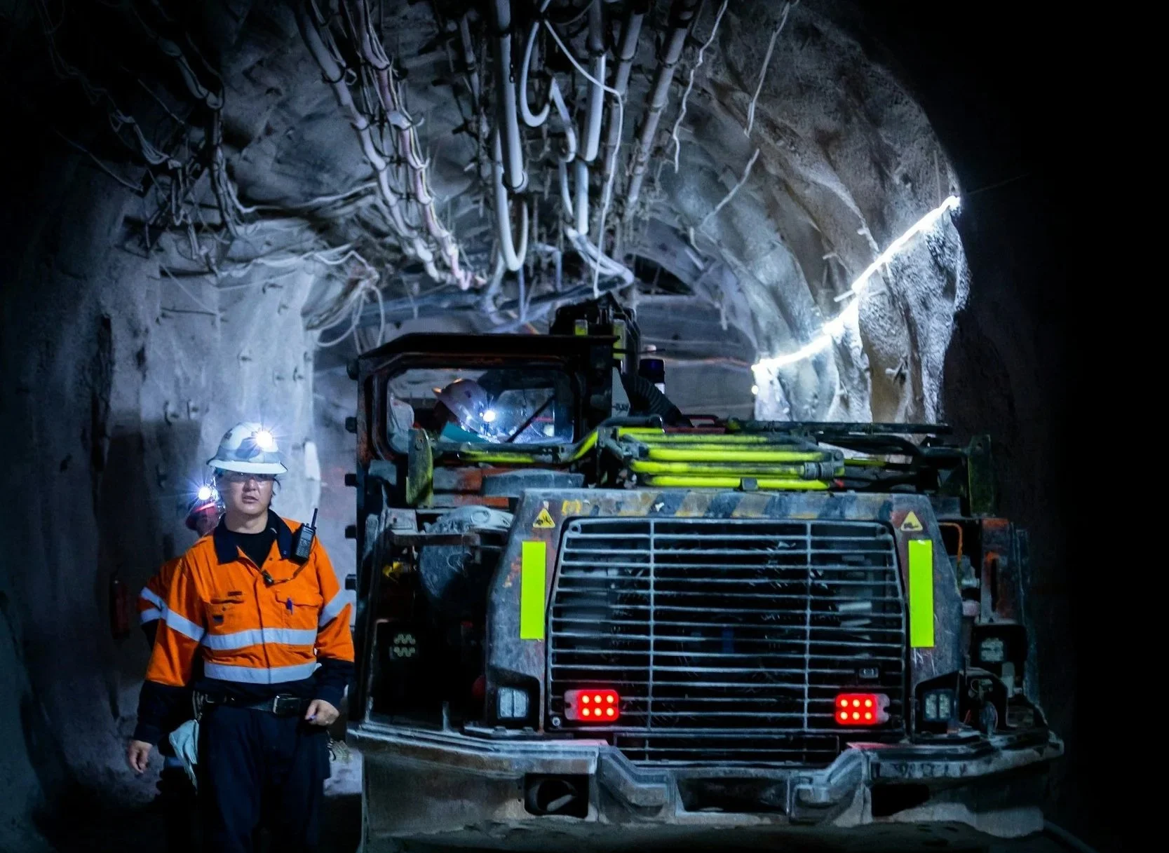
Aquanty’s HGS simulation technology is emerging as an integral part of deep geologic repository and mine closure design optimization to verify that post-mining hydrologic conditions meet stringent regulatory criteria.
Large-scale numerical simulation of groundwater flow and solute transport in discretely-fractured crystalline bedrock:
“A large-scale fluid flow and solute transport model was developed [using HydroGeoSphere] for the crystalline bedrock at Olkiluoto Island, Finland, which is considered as potential deep geological repository for spent nuclear fuel.” (Blessent et al., 2011)


Improving precision in regional scale numerical simulations of groundwater flow into underground openings:
A new tunnel boundary condition was developed for HydroGeoSphere to simulate changes to the water table from underground operations. Supports advanced tunnel dewatering simulation by incorporating excavation damage and grouted tunnel zones. Account for time-varying hydraulic conductivity, fracture development, and land surface subsistence.
-
![A landscape showing a dried, cracked lakebed with a mountain range in the background, overlaid with a warning icon of the Earth with a thermometer indicating high temperatures.]()
Climate Change Impact Analysis
-
![A digital topographic map with green landmasses, blue river channels, and yellow-brown terrain outlines, overlaid with a white gear icon containing a water droplet and a hand.]()
Water Resources Engineering and Consulting
-
![Scenic mountain landscape with snow-capped peaks reflecting in a calm lake, under a clear blue sky.]()
Watershed Management and Decision Support
-
![Open-pit mining quarry with terraced layers of earth and rocks, clear blue sky above.]()
Mine Operations and Closure Planning
-
![Person in a red and black plaid shirt using a tablet in a wheat field, with a white leaf and checkmark eco-friendly logo overlay]()
Agriculture & Forestry
-
![A cooling tower emitting steam at dusk with a large radiation warning symbol overlaid.]()
Nuclear Waste Management
-
![A digital illustration featuring a cloud, a shield with a checkmark, and a network of connections, symbolizing cloud security and protection.]()
Flood and Drought Risk Management, Insurance
-
![An aerial view of a coastal landscape with sandy beaches, grassy patches, and blue ocean waves, with a white overlay icon of a wave inside a circle.]()
Coastal Hydrology, Thermal Energy Transport and Density-Dependent Flow Applications


Connect with Aquanty
Let our experts guide you through our cutting-edge technology and demonstrate how our services can address your specific needs.