
Manitoba Co-operator - Hydrology forecasting tool drills down to field level

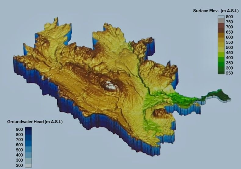
3D model of the Assiniboine River Basin created for Phase 1 of our project with the MFGA.
Aquanty’s long-standing partnership with the Manitoba Forage and Grassland Association (MFGA) and our ongoing work to model the hydrology of catchments in western Canada has led to yet another spotlight in the news.
A recent article by The Western Producer discusses how integrated hydrologic modelling with HydroGeoSphere can help agricultural producers (and other stakeholders) mitigate the impacts of extreme weather events, whether they be drought or flood.
Thank you to The Western Producer for this highlight; and well done representing Aquanty Dr. Steve Frey, as always!
Click here to read the article in The Manitoba Co-operator.
“Farmers in the Assiniboine River basin will soon have access to a new tool designed to help them make predictions about water flow at the field level.
The tool was developed by the hydrologic modelling firm Aquanty, in cooperation with the Manitoba Forage and Grasslands Association. They are able to combine their model with remote sensing data on things like soil moisture levels and real time groundwater monitoring sensors to set the initial conditions before launching a hydrologic forecast.
“Combining that with insights on how water management infrastructure is maintained during floods and droughts and using cloud computing infrastructure, we can readily construct these models and deliver them via an app to your fingertips,” said Steve Frey.
”

Screenshot of the MFGA Aquanty Forecast Tool showing the 15 watershed regions throughout Manitoba, Saskatchewan & North Dakota.