
HydroSphereAI Case Study: Nanaimo River Near Cassidy – January 2026 High-Flow Event
HydroSphereAI’s machine learning-driven forecasting system.
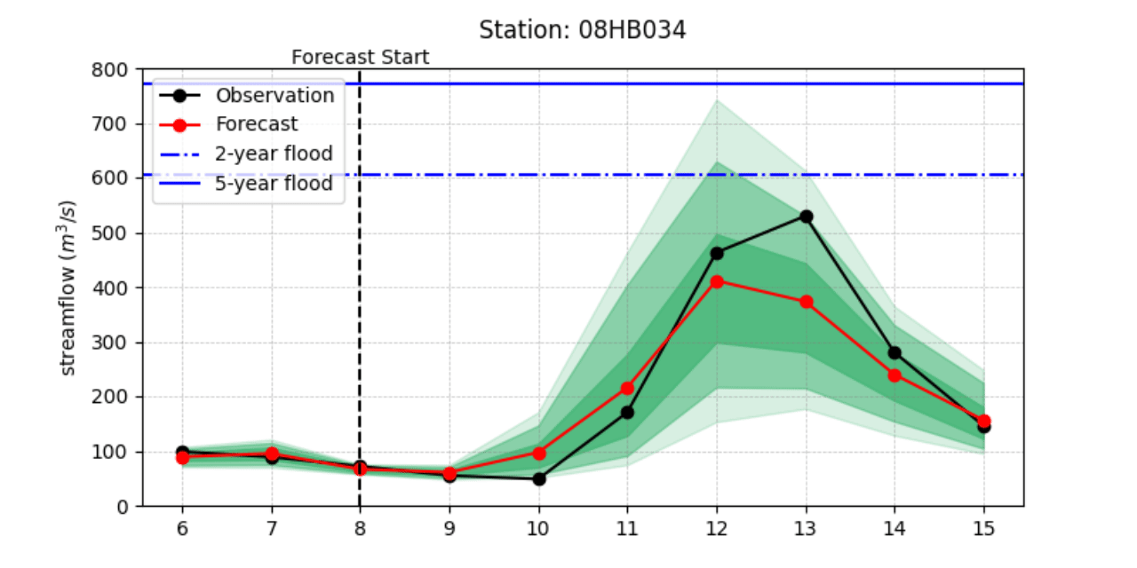
On January 12, 2026, the Nanaimo River near Cassidy (Water Survey of Canada Station 08HB034) experienced a significant high-flow event, cresting at the 2-year flood mark. Winter storm systems sweeping across Vancouver Island brought prolonged precipitation to the watershed, driving river discharge well above average levels for the season. This case study highlights how an early release version of HydroSphereAI (HSAI) tracked the event and how this information could be used by stakeholders and water managers.
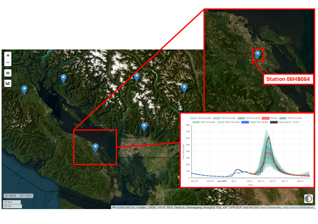
The Nanaimo River near Cassidy (Water Survey of Canada Station 08HB034).
Regional media coverage during the event reported that a flood warning had been issued for areas north of the Cassidy gauge as rainfall accumulated and river levels rose rapidly across the watershed. While the warning applied to a different monitoring location, it reflected the broader hydrometeorological conditions affecting central Vancouver Island, conditions that also drove the elevated flows observed at station 08HB034.
HydroSphereAI’s machine learning-driven forecasting system successfully predicted the event and anticipated its peak with remarkable accuracy.
Watershed Context
The Nanaimo River drains a substantial portion of central Vancouver Island, with Water Survey of Canada station 08HB034 monitoring flow on the mainstem near Cassidy. The watershed upstream of the gauge covers approximately 684 km², extending from the forested uplands of the Vancouver Island interior to lower elevation valley areas closer to the coast. This hydrometric station exemplifies typical winter flood dynamics in the region, where so-called Atmospheric Rivers associated with Pacific frontal systems frequently bring prolonged rainfall to the slopes of the West Coast.
During the January 2026 event, approximately 60–100 mm of rainfall fell across the mid-island region between January 8 and January 12, contributing to rising river levels not only at Cassidy but throughout the watershed. Reports of localized flooding concerns north of the station underscored the regional scale of the storm system and the hydrologic response underway.
Forecasting Challenge
The severity and local impact of fall and winter flood events in coastal British Columbia can be difficult to anticipate. While the Pacific storm systems that drive these events are often forecast with good meteorological skill, translating those forecasts into accurate predictions of local hydrological response and flood dynamics remains more challenging. This can lead to situations where the severity of flooding impacts within a watershed is underestimated. Key factors influencing the hydrologic response include:
Rain-on-snow interactions in higher elevations
Atmospheric river influences
Rapid temperature shifts affecting runoff generation
Back-to-back frontal systems saturating soils
When widespread rainfall prompts public flood warnings in parts of a watershed, water managers and emergency responders require clear, early insight into how downstream locations may respond. Reliable lead-time is critical for infrastructure preparation, public safety planning, and reservoir operations.
HydroSphereAI Performance Overview
HydroSphereAI began identifying and tracking the event peak as early as January 8, four days in advance of the observed peak on January 12. In the days leading up to the event:
Early forecasts successfully captured an increasing hydrograph trend, indicating a developing high-flow situation.
As forecast lead time decreased predicted streamflow patterns converged on the eventual observed peak.
HydroSphereAI’s probabilistic outputs consistently showed the correct timing window for elevated flows - this would have given potential decision-makers useful foresight even before the flood crest occurred.
Why This Matters
HydroSphereAI’s performance on the Nanaimo River during this winter event underscores several of its core strengths:
Early Signal Detection: Even at longer lead times, the model detected a trend toward elevated flows, alerting users to potential flood risk well in advance.
Adaptive Prediction Skills: Forecast accuracy improved as event approached, narrowing uncertainty around both timing and magnitude of the peak.
Operational Value: Reliable guidance over multiple days supports flood preparedness actions, such as reservoir management decisions, public safety planning, and resource allocation.
Conclusion
The January 2026 storm system highlighted the interconnected nature of hydrologic response across the Nanaimo River watershed. While flood warnings were issued north of the Cassidy station, elevated flows were observed throughout the basin, reinforcing the importance of regional-scale forecasting awareness.
As climate variability reshapes historical hydrological patterns on Vancouver Island, traditional forecasting approaches can struggle to anticipate the magnitude and timing of winter flood events driven by successive Pacific storm systems and intensifying Atmospheric Rivers.
Machine learning approaches like HydroSphereAI, which dynamically integrate real-time observations with meteorological forecasts, offer a scalable, data-driven solution that enhances flood readiness and resilience across the region.
For practitioners in flood risk management, water resource operations, and watershed planning, HydroSphereAI’s performance during this event demonstrates the value of AI-enabled forecasting as a critical tool in managing increasingly complex hydrological extremes.